Marten Falls First Nation (MFFN) Community Access Road
April 2022 update
Current and upcoming activities
Welcome to the Marten Falls First Nation (MFFN) Community Access Road April E-Blast with updates on current and upcoming activities. This E-Blast features:

Meet with us in-person this summer!
We are excited to share two upcoming in-person engagement opportunities:
- Upcoming Public Information Centre: The first Public Information Centre for the Environmental Assessment is being planned for early summer 2022. This will be an opportunity to meet the team in the Thunder Bay area (assuming public health guidelines allow gatherings), learn more about the planning process and share your feedback, ideas and community values related to the proposed all season access road. Stay tuned for more details.
- Prospectors & Developers Association of Canada (PDAC): We will be at the PDAC Conference at the Metro Toronto Convention Centre (Room 202D) in Toronto on June 14 and 15. The PDAC is the voice of mineral exploration and development in Canada. There will be a room dedicated to the three road projects at PDAC, including ours. We look forward to seeing you in-person!
Indigenous Knowledge Program
There is an Indigenous Knowledge Program in place to collect relevant information on Indigenous land and resource use and important cultural values in and around the proposed Community Access Road study area. The submission deadline for Indigenous Knowledge Program Studies to inform the EA / IA is June 30, 2022. Over the fall and winter, inputs from each Indigenous community will be discussed and included in the assessment. More details on the Indigenous Knowledge Program are available on the website.
Field Studies Updates
Due to snow and weather conditions, the Groundwater and Geochemistry Program has been postponed to September – December, 2022 and the remaining furbearer ground track surveys have been postponed to winter 2022 and 2023.
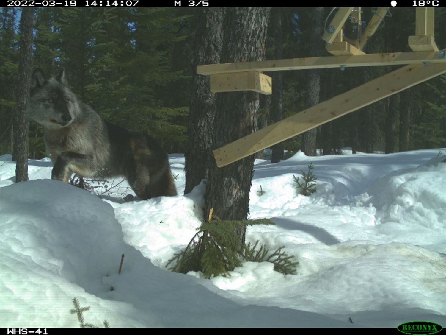
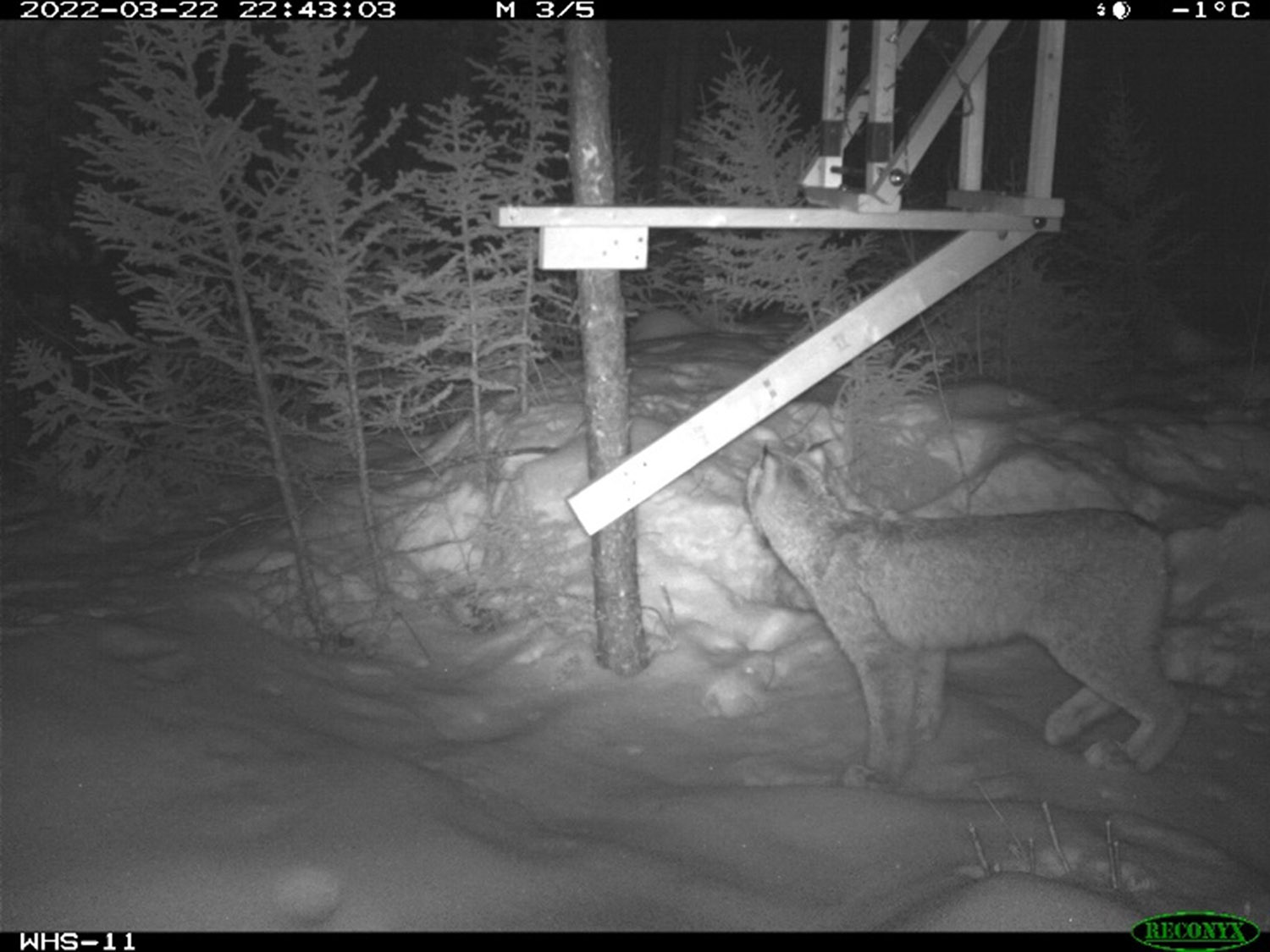
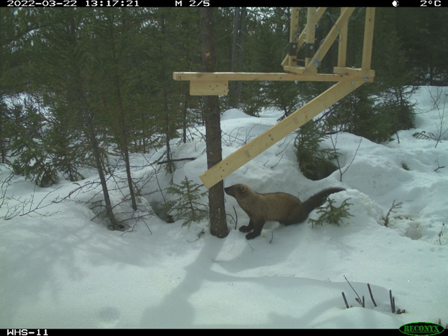
We continue to see new visitors investigating the wolverine hair snag trap locations, including a Grey Wolf, Canada Lynx and more. Check out some photos below!


Upcoming Field Studies
Our field crews are very busy in the upcoming spring and summer months! There are a lot of moving parts when scheduling spring and summer programs, including the spring melt, hunting seasons, accommodations, weather and on-going monitoring of COVID-19 situations. We appreciate your understanding as timelines shift.
Our field studies will be strengthened by the Indigenous Knowledge shared with us by MFFN and neighbouring Indigenous communities through the Indigenous Knowledge Program. In addition, study-specific Discussion Guides will continue to be distributed to our contact list to provide information about what the study or program is and why it’s important to the Community Access Road. An Early Spring Discussion Guide and Bird Discussion Guide were shared in March for all of the programs below.
Your input is important, and we want to make it easy for you to provide it! Discussion Guides will be sent out in advance of a program or study starting, so you have an opportunity to shape the program through your input, including sharing any Aboriginal and Treaty Rights and Interests in the area. If you have ideas on ways to make it easier for you to have a say, please let us know. We are all ears!
Below is a high-level overview of upcoming field study programs and their approximate timelines*
- Wolverine Hair Snag Surveys (May 2-10 and June 2022): Hair snag traps were placed in the study area in February 2022 to provide information about wolverine (wishkobishag) demographics (male / female). Crews have been returning each month to re-bait the hair snag traps. The traps will be re-baited one last time in May 2022 and hair snag traps will be removed in June 2022. This field program will continue in 2023. Learn more about wolverines in our video here.
- Bird Autonomous Recording Units (May 2-10 and Fall 2022): Autonomous Recording Units (ARU) will be set-up in the study area. ARU’s will be deployed by crews while out re-baiting wolverine hair snag traps and this program will continue throughout summer and fall, 2022. Read the Discussion Guide and share your feedback.
- Ungulate Remote Camera Check (May 2-10 and Fall 2022): Field crews will return to remote cameras deployed in June 2021 to inspect cameras and replace batteries and memory cards. This program will continue into 2023. Learn more about ungulates in our video here.
- Caribou (atik) Mortality Investigation (May 2-10 and Fall 2022): In February 2021, 30 radio collars were placed on adult female caribou (atik) to collect data over three years. Mortality investigations will look into collared caribou that have not moved in 12 hours, to assess their cause of mortality (e.g., predation, hunter, poor health, natural causes). Mortality investigations will continue to be conducted as needed. Learn more about ungulates in our video here.
- Aerial Waterfowl Migration Surveys (May 13-15 and Fall 2022): Transects, or straight lines, will be flown in spring and fall to observe waterfowl (such as ducks; Shesheeb) and shorebird stopover and staging locations, and to observe raptors nesting locations. Read the Discussion Guide and share your feedback.
- Breeding Bird Aerial Surveys (May 13-15, June (two trips) 2022): Similar to Aerial Waterfowl Migration Surveys, these aerial surveys will focus on waterfowl and raptor nesting in the breeding season (and does not include shorebirds). Read the Discussion Guide and share your feedback.
- Physiography, Terrain and Soils Program (late May / early June, 2022): This field program will collect information on geologic features, and soil conditions including moisture and nutrient levels. This information is important to better understand the current conditions and relationship between the soil and the ecosystems that depend on it, including plants that grow in the forest or wetlands (asabi’biiya or asabi’gama). Our collection approach helps limit disturbances in the area. Soil data will be collected by setting up soil plots, digging soil pits to a depth of 50-60cm with a shovel and hand augering to 125cm to collect soil data at various depths to test the data to verify soil and terrain data for the area.
- Breeding Bird Point Counts, Marsh Playback Surveys and Eastern Whip-poor-will Autonomous Recording Units (early and late June 2022): Skilled observers will use three survey methods to identify birds, including marsh birds, breeding birds and the Eastern Whip-poor-will (a Species at Risk), by sight and sound. Species at Risk birds are those that are listed as endangered or special concern. Species at Risk birds in the study area include Olive-Sided Flycatcher and Common Nighthawk (bekshkew). Read the Discussion Guide and share your feedback.
- Vegetation Program (mid July 2022): Vegetation plots will be set up to collect samples and record to verify mapping of vegetation information for the area. Learn more about vegetation in our video and Discussion Guide here.
- Surface Water and Fish and Fish Habitat Program (mid June 2022): Field crews will collect information on surface water (e.g., lakes, rivers, streams) quantity and quality, sediment quality (e.g., sand, silt, clay) and benthic invertebrates (organisms that live at the bottom of lakes, rivers and streams). This work will be taking place at water crossings along both of the route alternatives being studied. Additional fishing effort and fish habitat information may also be collected in spring. Learn more about surface water and fish and fish habitat in our video and Discussion Guide here.
- Air Monitoring Program (late Spring / early Summer 2022): Following data collection of current air quality over one year, the air monitoring program will be wrapping up with technicians decommissioning and removing air monitor equipment in MFFN.
- Groundwater and Geochemistry Program (September to December 2022): Installation of monitoring wells to assess groundwater fluctuations, seasonal changes in water quality and develop an understanding of current conditions. Water, soil, and bedrock samples will also be collected to understand key rock and groundwater conditions. This program will continue into 2023. Learn more about groundwater and geochemistry in our video and Discussion Guide here.
Our website is updated regularly with Field Notices that you can view at your convenience.
The Early Spring Field Notice distributed on April 29, 2022 can be viewed here.
*Timelines and programs are approximate and may shift; we will provide updates as required
If you have any questions, comments or feedback on the planned studies, we would like to hear from you (contact information below).
Please contact us at any time with questions or comments, or to schedule a meeting. Meetings can be arranged in-person in any community (adhering to health and safety protocols as required), in the Thunder Bay area, or remotely. We want to hear what you have to say.
Questions or comments?
Questions or comments? Contact us at 1-800-764-9114 or info@martenfallsaccessroad.ca.
Follow us on Facebook: https://www.facebook.com/MFFNCommunityAccessRoadProject/
