Download the PDF version of this Discussion Guide (PDF 5 MB)
The Groundwater and Geochemistry Summer Field Program will soon begin for the federal Impact Assessment (IA) for Marten Falls First Nation’s proposed All-Season Community Access Road. The Terms of Reference (ToR), a framework to guide the provincial Environmental Assessment (EA), is currently with the Ministry of the Environment, Conservation and Parks for review and decision. If the ToR is approved, this field program will also inform the provincial EA.
The purpose of this Discussion Guide is to provide an overview of the Groundwater and Geochemistry Summer Field Program and to receive your feedback on key questions. Your insight will help shape the program.
A field study notice will be distributed once dates are confirmed.
What's Happening?
An important part of this field program is understanding potential effects the proposed Community Access Road may have on groundwater in the area. The purpose of the Groundwater and Geochemistry Field Program is to understand the current groundwater quantity in the study area—to answer the question how much is there—and to determine the quality of the groundwater—or more specifically to understand its chemical make-up. At the same time, we will also be sampling soil and areas of potential aggregate sources (where construction materials could be found) to identify minerals or chemicals that could affect water quality if disturbed or used during construction.
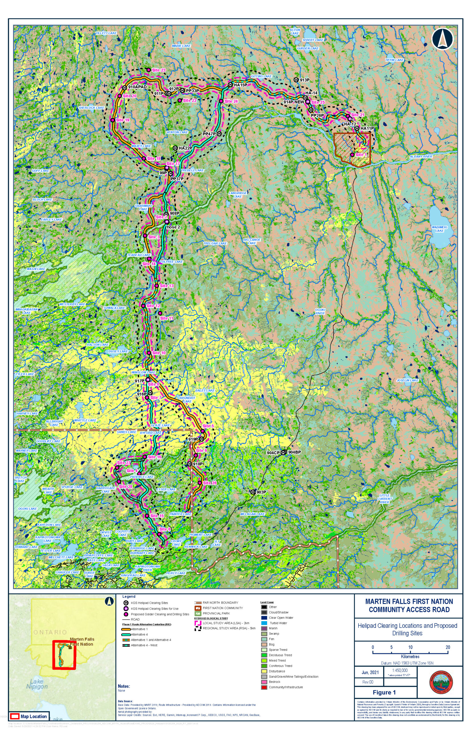
Monitoring wells will be set up in the study area (one kilometre on either side of both route alternatives) and sampled three times per year—in the spring, summer and fall—for two years. When sampling, field technicians will measure groundwater levels and flow rate, complete in-field tests for basic chemistry, and collect samples to send for laboratory analysis. The information collected on groundwater levels, quality and seasonal fluctuations will be used to develop an understanding of existing conditions.
Field crews will make every effort to avoid identified sensitive habitats and areas when selecting the location of the groundwater wells. The wells will extend into the ground far enough to reach the groundwater; the depth of each well will vary by location. Above ground, the wells are relatively small in size, about 10 centimetres across and 75 centimetres tall. When the wells are no longer required, they will be decommissioned—this means they will be filled in and sealed.
There are three stages for the Groundwater and Geochemistry Field Program that will take place in 2021: 1) Groundwater well drilling and installation (August to October); 2) groundwater well monitoring, testing and sampling (following installation) (October); and 3) a community well survey and sampling in Marten Falls First Nation to identify and assess wells and springs used as drinking water sources (timing to be determined). Dates are estimates and detailed information about the future programs will be shared through field notices at a later date.
What is groundwater?
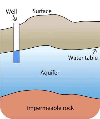
Groundwater is any water that is found below the Earth’s surface. Groundwater is held below the ground under rock layers known as aquifers. Groundwater can come in contact with the surface through springs and wells.
What is geochemistry?
Geochemistry is the study of the chemicals held in rocks and minerals.
When?
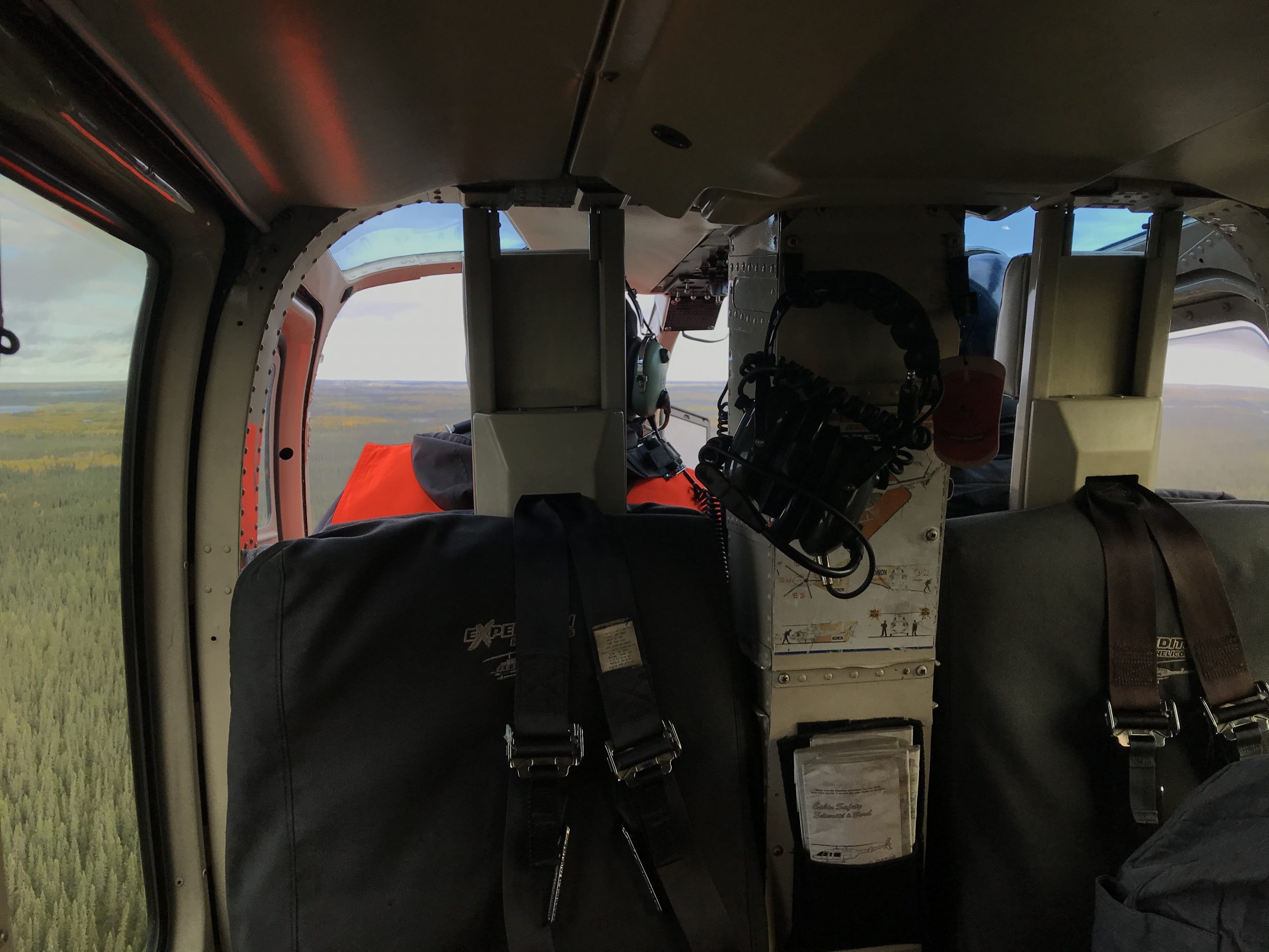
The field program will take place starting in Summer 2021. For approximately the first three weeks of the program, the field crew will identify well locations and clear brush and trees to allow helicopter and drill rig access to those locations. Once tree clearing is complete, the monitoring wells will be installed; this is anticipated to take roughly 30 days to complete. Field technicians will then monitor, test and sample each monitoring well over a period of approximately two to three weeks. At a later date, consultation and engagement activities will focus on identifying current and historical drinking water sources within the regional study area. Water well surveys will occur at the locations where drinking water sources were identified.

We Need Your Input!
Both Indigenous Knowledge and western science are key to understanding the environment, and will help to decide where the road will go. Currently, we are looking for high-level feedback on items we should be aware of when undertaking this season’s scientific field studies in the areas identified on the provided maps. The planned field studies involve mostly low impact activities and will follow all applicable regulations and guidelines. Indigenous persons continue to accompany the survey crews to support this important work.
Indigenous Knowledge and information on Indigenous land and resource use in the area of the proposed routes can be shared through the Project’s Indigenous Knowledge Program. If you have sensitive and confidential information that you would like to share through this Program, please let us know. We will ensure your knowledge is protected.
Your input is an important part of shaping this field program. If you have any feedback on the following questions, we would like to hear from you:


